My Genealogy Hound
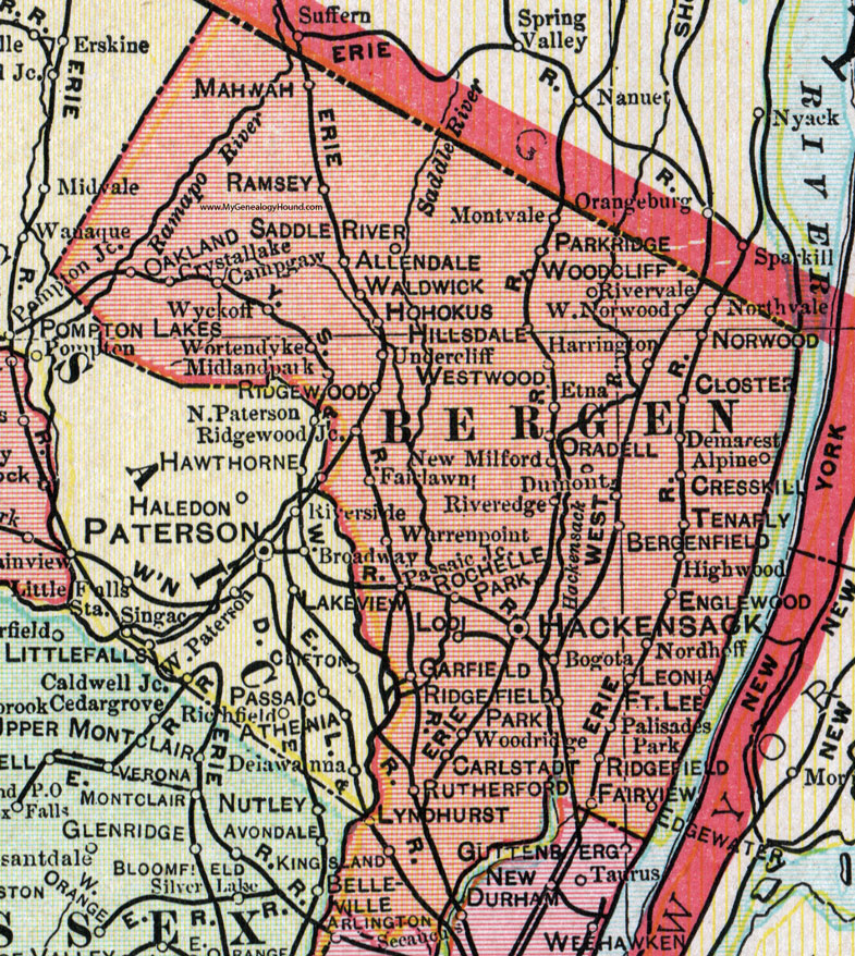
Bergen County, New Jersey, 1905 Map

Locations shown include: Allendale, Alpine, Bergenfield, Bogota, Broadway, Campgaw, Carlstadt, Closter, Cresskill, Crystallake (Crystal Lake), Demarest, Dumont, Edgewater, Englewood, Etna, Fairlawn, Fairview, Fort Lee, Garfield, Hackensack, Harrington, Highwood, Hillsdale, Hohokus (Ho-Ho-Kus), Kingsland, Leonia, Lodi, Lyndhurst, Mahwah, Midlandpark (Midland Park), Montvale, New Milford, Nordhofe, Norwood, Oakland, Oradell, Palisades Park, Parkridge (Park Ridge), Passaic Junction, Ramsey, Ridgefield, Ridgefield Park, Ridgewood, Ridgewood Junction, Riveredge (River Edge), Rivervale, Rochelle Park, Rutherford, Saddle River, Tenafly, Undercliff, Waldwick, Warrenpoint (Warren Point), West Norwood, Westwood, Woodcliff, Woodridge (Wood-Ridge), Wortendyke, Wyckoff.
This Bergen County map is a portion of a 1905 New Jersey map by George F. Cram.
View additional New Jersey Maps here: New Jersey County Maps
County maps from other states can be viewed here: State County Maps
Use the links at the top right of this page to search or browse thousands of family biographies.