My Genealogy Hound
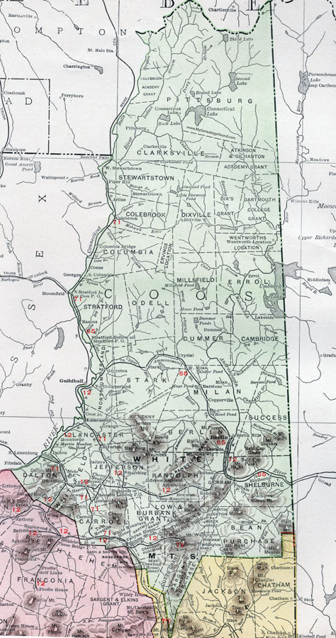
Coos County, New Hampshire Map, 1912

(See enlarged portions below)
Locations shown include: Appalachia, Arlins, Baileys, Beecher Falls, Bennetts Landing, Berlin, Berlin Mills, Bloomfield, Bowman, Boy Mountain, Bretton Woods, Carroll, Cascade, Cherry Mt., Clarksville, Colebrook, Columbia, Columbia Bridge, Cones, Connecticut Lake, Coos Junction, Coos, Copperville, Crystal, Dalton, Dixville, Dummer, Errol, Fabyan House, Georges, Gorham, Grange, Groveton, Hazens, Highlands, Jefferson, Jefferson Highland, Jefferson Junction, Lakeside, Lancaster, Martstons, Masons, Meadows, Milan, Mountorne, North Stratford Junction, Northumberland, Percy, Piper Hill, Pittsburg, Quebec Junction, Randon, Riverton, Scott, Shelburne, South Columbia, Stark, Starrking, Stewartstown, Stratford Hollow, Stratford, Twin Mountain, Wentworth Location, West Milan, West Stewartstown, Whitefield, White Mountain House.
This Cheshire County map is a portion of a 1912 New Hampshire map by Rand McNally.

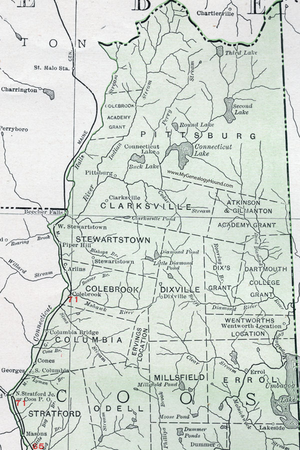
Enlarged map of the northern portion of Coos County, New Hampshire.

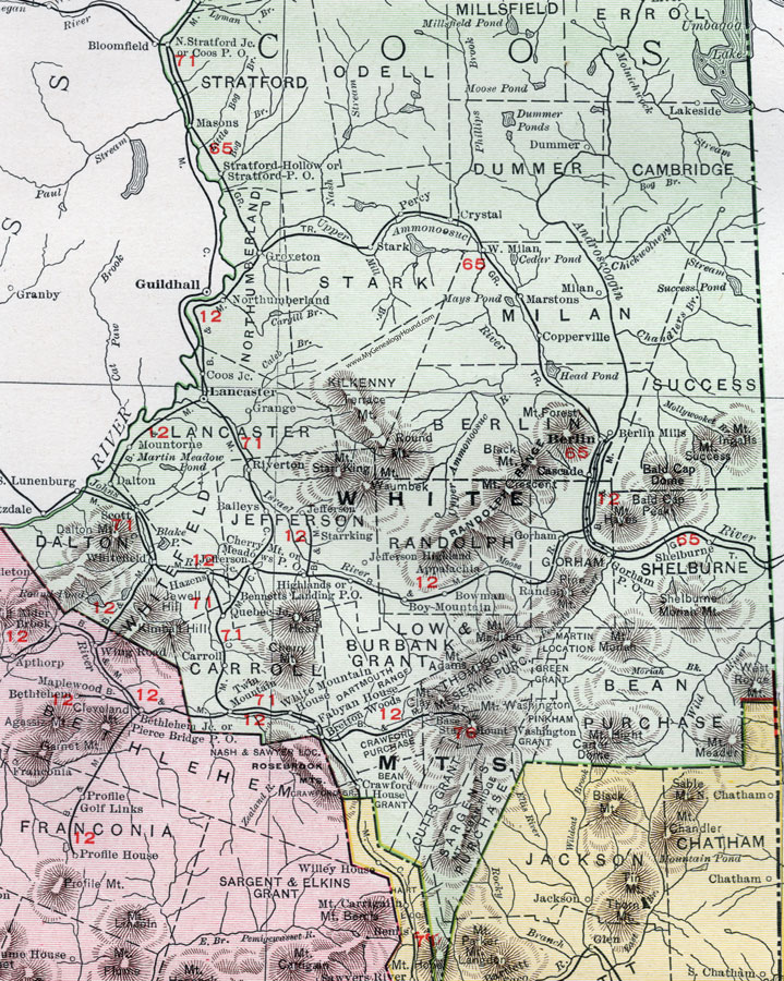
Enlarged map of the southern portion of Coos County, New Hampshire.
View additional New Hampshire maps here: New Hampshire County Maps
County maps from other states can be viewed here: State County Maps
Use the links at the top right of this page to search or browse thousands of family biographies.