My Genealogy Hound
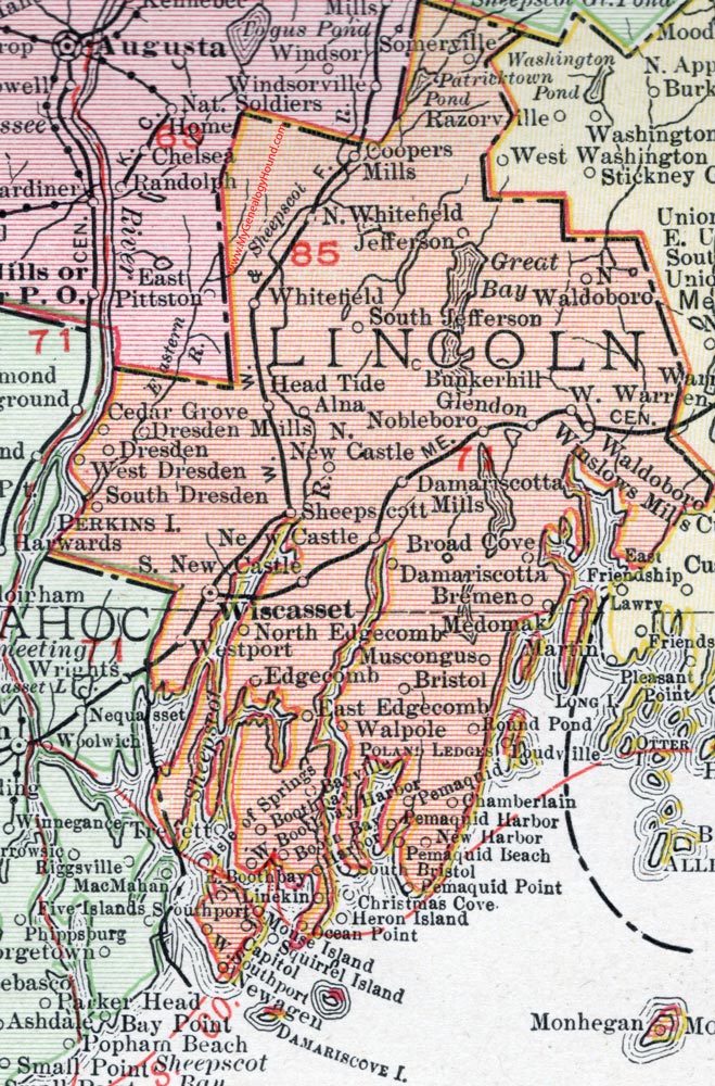
Lincoln County, Maine, 1912 Map

Locations shown include: Alna, Bayville, Boothbay, Boothbay Harbor, Bremen, Bristol, Broad Cove, Bunkerhill, Capitol, Cedar Grove, Chamberlin, Christmas Cove, Coopers Mills, Damariscotta, Damariscotta Mills, Dresden, Dresden Mills, East Boothbay, East Edgecomb, Edgecomb, Glendon, Head Tide, Heron Island, Isle of Springs, Jefferson, Linekin, Medomak, Mouse Island, Muscongus, Newagen, Newcastle, New Harbor, Nobleboro, North Edgecomb, North New Castle, North Waldoboro, North Whitefield, Ocean Point, Pemaquid, Pemaquid Beach, Pemaquid Harbor, Pemaquid Point, Round Pond, Sheepscott, Somerville, South Britol, South Dresden, South Jefferson, South New Castle, Southport, Squirrel Island, Trevett, Waldoboro, Walpole, West Boothbay Harbor, West Dresden, West Southport, Westport, Whitefield, Winslows Mills, Wiscasset.
This Lincoln County map is a portion of a 1912 map of Maine by Rand McNally.
View additional Maine Maps here: Maine County Maps
County maps from other states can be viewed here: State County Maps
Use the links at the top right of this page to search or browse thousands of family biographies.