My Genealogy Hound
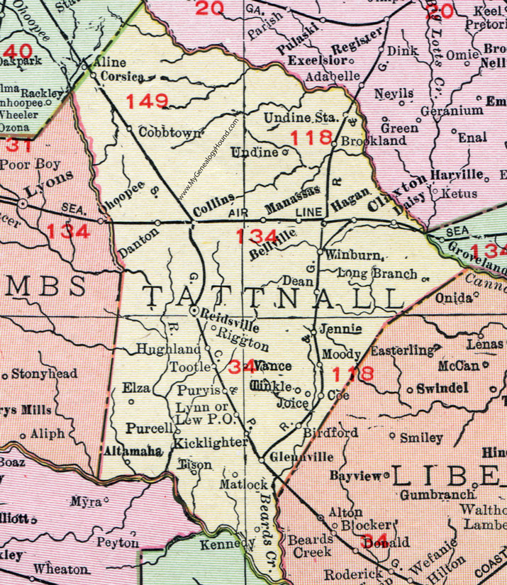
Tattnall County, Georgia, 1911, Map

Locations shown include: Altamaha, Belleville, Birdford, Brookland, Claxton, Cobbtown, Coe, Collins, Corsica, Daisy, Danton, Dean, Elza, Glennville, Hagan, Hughland, Jennie, Joice, Kennedy, Kicklighter, Lew P.O., Long Branch, Lynn, Manassas, Matlock, Moody, Purcell, Purvis, Reidsville, Riggton, Tinkle, Tison, Tootle, Undine, Undine Station, Vance, Winburn.
This Tattnall County map is a portion of a 1911 Georgia map by Rand McNally.
View additional Georgia Maps here: Georgia County Maps
County maps from other states can be viewed here: State County Maps
Use the links at the top right of this page to search or browse thousands of family biographies, historic maps and vintage photos.