My Genealogy Hound
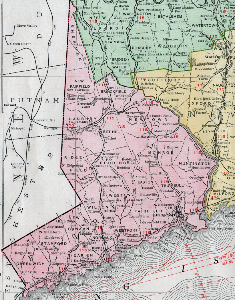
Fairfield County, Connecticut, 1911 Map

Locations shown include: Adams, Aspetuck, Balls Pond, Bethel, Botsford, Branchville, Bridgeport, Brookfield, Brookfield Center, Brookfield Junction, Cannon Station, Cooper, Coscob, Cranbury, Danbury, Darien, East Danbury, East Norwalk, Easton, Fairfield, Fair Grounds, Florida, Georgetown, Glenbrook, Glenville, Greenfield Hill, Greens Farms, Greenwich, Hawleyville, Hawthorne, High Ridge, Hobart, Huntington, Hurlbutt, Lockwood, Long Hill, Long Ridge, Lyons Plain, Mianus, Mill Plain, Monroe, Monroe Station, New Canaan, New Fairfield, Newtown, Nichols, North Bridgeport, North Newtown, North Ridgefield, North Stamford, North Wilton, Noroton, Noroton Heights P O, Norwalk, Oronoque, Plattsville, Redding, Redding Ridge, Ridgebury, Ridgefield, Riverbank, Riverside, Round Hill, Rowayton, Sandy Hook, Saugatuck P O, Shelton, Sherman, Silver Mine, Sound Beach, South Norwalk, Southport, South Wilton, Springdale, Stamford, Stanwich, Stepney, Stepney Depot, Stevenson, Stratford, Taconic, Talmadge Hill, Topstone, Trumbull, Weston, Westport, West Redding P O, Wilson Point, Wilton, Winnipauk.
This Fairfield County map is a portion of a 1911 Connecticut map by Rand McNally.
View additional Connecticut Maps here: Connecticut County Maps
County maps from other states can be viewed here: State County Maps
Use the links at the top right of this page to search or browse thousands of family biographies.