My Genealogy Hound
Autauga County, Alabama, 1911 Map
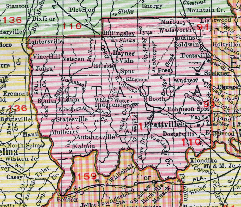
Locations shown include: Andrew, Autaugaville, Baldwin, Billingsley, Bonita, Booth, Dosterville, Fays, Fremont, Haynes, Hillside, Huckabee, Independence, Jones, Kalmia, Kingston, Marbury, Milton, Mulberry, Netezen, Posey, Prattville, Robinson Springs, Rollins, Spur, Statesville, Tyus, Vida, Vine Hill, Wadsworth, White Water, Winslow.
This Autauga County map is a portion of a 1911 Alabama map by Rand McNally.
View additional Alabama County Maps here: Alabama County Maps
County maps from other states can be viewed here: State County Maps
Use the links at the top right of this page to search or browse thousands of family biographies.